A Short St. John History Lesson
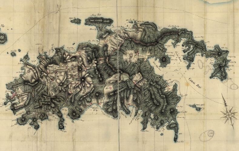
As we walked the property last week, staking out future home sites and the pool, we were intrigued at the terracing and old stone walls we found on the property. At some point, this was obviously a farm and from the condition of the walls and stone, apparently quite old. Aside from these walls, there are no apparent ruins anywhere on the property. My friend Mike was perusing a volume of "St. John Life In Five Quarters" by Robin Swank, David Knight, Bruce Shoonover and Eleanor Gibney when we came across a map by Oxholm.
In 1780 Oxholm produced the first proper map of St. John. The island in his time was partially uncultivated and had only a few plantations in operation. There were only about sixty European inhabitants on the island.
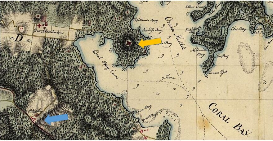
The Blue arrow points to where we think the Calichi land is located. Looking directly over Fortsberg, as indicated by the Orange arrow. "The fort on the top of the steep Fortsbjerg (Fortsberg) at Coral Bay on the east end of St. John was the place where the slave rebellion in 1733 started. After having taken over the fort, the slaves gained control of practically the entire island and were not defeated for eight months. After this traumatic experience, the Danes blew up the fort at Coral Bay and moved the operations to Cruz Bay on the island's west end. Fifty years later, when Oxholm drew the ruins, most of the walls and the entire officer's house in the fort yard had disappeared. Today, the ruins lie much as they were in Oxholm's time. " (Danish National Archives, Rentekammersamlingen, no. 337.343) Turns out that our property looks to be identified on this map as being owned by one P Machier.

Interesting, since this land was sold in 1972 by the Marsh family of St. John to the family trust from whom we eventually acquired the land. Given the condition of the property, it certainly would make sense then that Calichi is sitting on one of St. John's earliest plantations dating back to the 18 century. We also came across a video clip from the dedication of the National Park in 1956. There is no sound, but gives you an appreciation for just how little things have really changed. We were amazed to see that the first 15 seconds of this video are a panorama of St. John's East End very near, if not just below the Calichi site.
Mike got out the metal detector and is searching around for any artifacts we can find that might give us some better insight into the daily lives of those who came before us. Well, I was about to publish this yesterday, but something told me to hold off to see how Mike's first foray with the metal detector went.
Sure enough, he found a coin about an hour into his search. The condition is very rough, and we're heading to town to speak with a local jeweler about the safest way to restore the coin to as good a shape as we can. Based upon what we can see, we believe it to be a coin minted in 1905 in Copenhagen specifically for the Dutch West Indies. We'll have a better idea after we visit the jeweler this morning. I'll be sure to post an update after we've cleaned it up a bit and see how accurate our guess is.
Obviously, we will do everything possible to preserve as many of these walls as possible. But it is interesting to have discovered a bit more about the history of this beautiful place. We are honored to be it's caretakers and create something responsible and sustaining for this historic piece of beautiful St. Jan.